Google has announced its Maps app will now give users live public transport information in the UK and five other prominent locations in Europe and the United States.
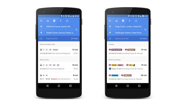
The real-time updates will let you know when buses, metros and subway systems will actually arrive rather than simply their regularly scheduled time.
Not only will you receive live arrivals information, you’ll also get notifications when your chosen method of transport is leaving the origin station so you can plan accordingly.
“
Google has added more than 25 new data partners in the applicable areas, which are the UK, Netherlands, Budapest, Chicago, San Francisco and Seattle.
If you’re not in one of those locations, fear not, Google also has some neat updates for its existing transit information in 18,000 cities and 64 countries.
“Starting today in Google Maps, relevant journeys are handily arranged and summarized in the app—so it’s easy to know at a glance how long you’ll be waiting and what your other options are if you just miss that bus,” the company added.
Read more: Google I/O 2015: Everything that happened
The launch, which appears to be for both iOS and Android, is ideally timed by Google to counter Apple’s expected announcement of public transport information within a revamped Maps app in iOS 9.
The company is expected to announce the Maps Transit service in six cities, when it previews the new mobile operating system at WWDC next week.

Editorial independence
Editorial independence means being able to give an unbiased verdict about a product or company, with the avoidance of conflicts of interest. To ensure this is possible, every member of the editorial staff follows a clear code of conduct.
Professional conduct
We also expect our journalists to follow clear ethical standards in their work. Our staff members must strive for honesty and accuracy in everything they do. We follow the IPSO Editors’ code of practice to underpin these standards.